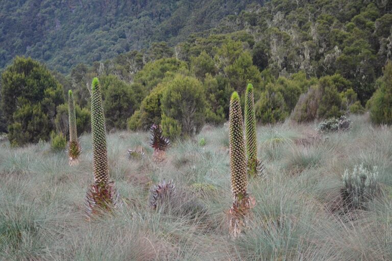
The Rwenzori do not reveal themselves all at once. From the rift floor they appear as a long, cloud-wrapped wall on the Uganda–DR Congo frontier. Inside the range, valleys divide, rivers rise from bog and lake, and vegetation grows into forms that seem scaled for another climate: giant heather hung with moss, lobelias above head height and groundsels standing like small trees. Higher still, wet rock replaces peat and tussock. The remaining ice lies on steep peaks rather than on the broad dome of a volcano.
Older expedition accounts sometimes use the spelling Ruwenzori; the protected range and national park now use Rwenzori.
This is why a Rwenzori expedition needs to be chosen by objective. Some travellers want a demanding landscape trek through the afro-alpine zone without technical climbing. Others want a full circuit of the central mountains. A Margherita Peak attempt adds glacier travel, fixed protection, scrambling and a summit day whose feasibility depends on weather, ice and the team’s condition. Calling every journey a “summit trek” hides the decisions that make it safe.
Rwenzori at a glance
- Highest point: Margherita Peak, 5,109 metres, on Mount Stanley.
- Mountain type: a tectonically uplifted fault-block range, not a volcano.
- Main Uganda trail systems: the Central Circuit from the Nyakalengija side and the Kilembe route from the south.
- Landscape trekking: possible without attempting a technical summit.
- Margherita summit: a mountaineering objective requiring specialist equipment, instruction and conditions suitable for rock and ice.
- Weather: wet and changeable in every month; mud, bog and cloud are part of the range.
Choose the journey before the summit
The most useful first question is not “which route is best?” but “what do you want the mountain to be?” A photographer interested in vegetation and lakes may value time in the Bujuku or Mutinda valleys more than a pre-dawn summit push. A strong hillwalker may want the physical and geographic satisfaction of a full circuit. A climber seeking Margherita must accept that reaching the summit is conditional: a responsible guide may turn the party around for weather, ice, pace, illness or an unsafe team dynamic.
Central Circuit
The Central Circuit begins near Nyakalengija and enters the Mubuku valley. Its logic is circular: the trail climbs through forest and heather, reaches the high central basins, crosses major passes and returns by a different valley. Classic stages connect the lower camps with John Matte, Bujuku, Elena, Kitandara and Guy Yeoman, although exact overnight use can change with route conditions and operator planning.
For walkers, the circuit offers the range’s most complete sense of enclosure. Bujuku Valley sits between Mount Stanley, Mount Speke and Mount Baker. Scott Elliot Pass opens towards the Kitandara lakes. The return traverses Freshfield Pass and descends through bog and forest. For Margherita climbers, Elena is the high base, but the summit day is an addition to the circuit rather than the measure of its worth.
Kilembe Trail
The Kilembe system approaches through the Nyamwamba valley from the southern side of the range. It is an out-and-back network rather than the same circuit, with carefully staged camps gaining height through forest, heather, alpine valleys and glacial lakes. Routes can be built towards Mutinda Lookout, the Kitandara area, Mount Luigi di Savoia and Mount Stanley.
The approach is attractive for deliberate acclimatisation and for travellers who want several high landscape days before the technical summit stage. It also allows shorter mountain programmes that reach distinctive afro-alpine country without presenting Margherita as compulsory. The operating itinerary must be confirmed against current camp use, bridge conditions, river levels and the chosen objective.
Central Circuit or Kilembe?
| Question | Central Circuit | Kilembe |
|---|---|---|
| Route character | A true circuit through the central valleys and passes. | A southern approach using a staged network of valleys, lakes and high camps. |
| Best for | Walkers who value a complete mountain circuit and the Bujuku–Kitandara geography. | Travellers who want a gradual southern approach, flexible landscape objectives or a Mount Stanley attempt from the Kilembe side. |
| Technical summit | Margherita commonly attempted from Elena within the circuit. | Margherita approached through the southern/high-lake system. |
| What both require | Fitness, waterproof systems, tolerance for mud, local mountain guides, porters and flexible decision-making. | |
Six massifs, not one summit
The high Rwenzori are formed by several mountain massifs. Mount Stanley carries Margherita and Alexandra, the range’s highest summits. Mount Speke rises east of the Bujuku valley; Mount Baker stands to the south. Mount Emin, Mount Gessi and Mount Luigi di Savoia complete the principal high groups. Valleys, passes and lakes between them create the experience of the range.
Names on older maps can suggest a tidy alpine system. On the ground, the terrain is more complicated: peat holds water, boardwalks may end, streams alter after rain, and cloud removes the visual reference of the next peak. The mountain team’s local knowledge is therefore more important than a diagram of camp elevations.
From rainforest to equatorial ice
The Rwenzori’s altitude, rainfall and isolation produce one of Africa’s most remarkable vegetation sequences. Lower montane forest holds birds and primates. Bamboo becomes prominent with height. Giant heather forms dark, twisted woodland in which moss and lichen collect moisture from cloud. Above it, giant lobelias and groundsels occupy wet valleys and slopes alongside everlasting flowers, tussock and sedge.
The bog is not a decorative backdrop. It changes the physical work of every day. Boots sink, roots roll, and boardwalks become slippery. Gumboots are often more useful than rigid trekking boots for lower and middle stages; technical footwear may be carried for the summit. A good kit plan treats dry socks, waterproof trousers, pack liners and a disciplined wet/dry system as safety equipment.
Rwenzori Mountains National Park protects 996 square kilometres of the range and is both a UNESCO World Heritage property and a Ramsar wetland. Its rivers contribute to the Nile system and sustain communities and agriculture far below the peaks. The mountain is an ecological water tower as well as a climbing destination.
The remaining glaciers
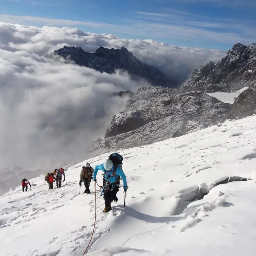
Early expeditions described extensive equatorial ice on the highest massifs. That ice has retreated dramatically. Today the surviving glaciers are smaller, fragmented and changing. Climate warming is the principal long-term pressure; local weather, dark debris, slope and aspect affect the speed and appearance of loss on individual bodies of ice.
For climbers this is not only a conservation story. Retreat exposes steeper rock, changes the transitions between glacier and ridge, and can make older route descriptions misleading. Crampons, ropes and fixed lines do not turn the summit into a predictable product. The guide must assess the route that exists on the day, not the route remembered from a photograph.
Margherita Peak: trekking ends where mountaineering begins
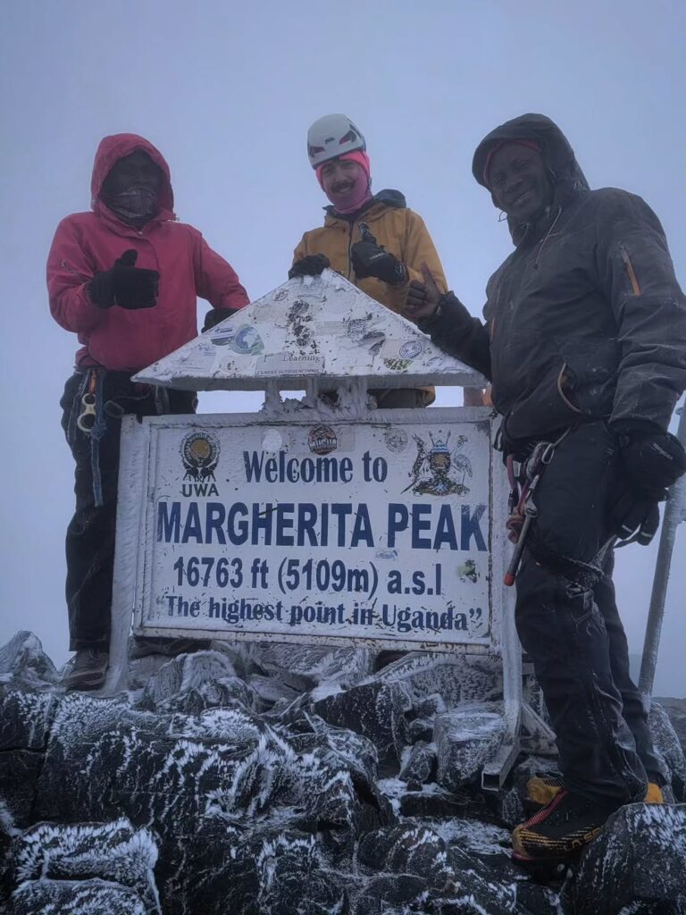
Margherita is Africa’s third-highest summit. The normal Uganda approaches involve a long high-altitude trek followed by a technical summit stage. Depending on current conditions, climbers may use helmet, harness, rope, crampons and ice axe, negotiate fixed protection and move across exposed rock or ice in darkness. Equipment and methods must be matched to the operator’s current risk assessment.
Previous crampon use helps, but no equipment list substitutes for movement skill. We assess experience honestly and arrange instruction where appropriate. Climbers should be comfortable with steep ground, cold hands, clipping systems and following precise guide commands when tired. A traveller whose main goal is the landscape can choose a high trek without being pushed into a summit attempt.
Why a summit may be turned around
- electrical activity, heavy precipitation, poor visibility or unsafe wind;
- fresh snow or ice conditions beyond the team’s equipment and competence;
- slow progress that removes the margin for descent;
- altitude illness, cold injury, exhaustion or loss of coordination;
- rockfall, damaged protection or a route change judged unsafe.
Turning around is a guide’s professional responsibility. A premium expedition is not one that promises the summit most loudly; it is one that protects the people who must still descend.
Altitude and acclimatisation
The Rwenzori begin lower and wetter than many travellers expect, but the high camps and summits create genuine altitude exposure. Headache, appetite change and poor sleep can occur before the technical day. Ascending gradually, drinking to thirst, eating consistently and reporting symptoms early give the guide useful information. Hiding illness to protect a summit attempt is dangerous.
Fitness does not prevent acute mountain sickness. Strong athletes can ascend too quickly and may be less willing to slow down. We use a deliberately restrained pace, monitor the group and maintain the option to rest, descend or change the objective.
Life on the mountain
Accommodation is simple. Depending on route and stage, teams use basic huts, shelters or tents. Drying space is limited; sleeping systems must remain protected from moisture. Meals need to be warm, substantial and practical at altitude, combining familiar carbohydrates and proteins with locally supplied ingredients. Dietary needs should be discussed before the team leaves the trailhead, not discovered at a high camp.
Days can begin early but should not be rushed. The terrain sets the pace. Staff may move ahead with shared equipment, yet loads must remain controlled. Guests carry a daypack with water, waterproofs, insulation, personal medication, snacks and camera protection.
Practical planning
How long to allow
A full Central Circuit is commonly planned around a week on the mountain, with extra time when adding Margherita. The Kilembe approach can support shorter landscape treks or longer summit programmes. We recommend arrival before the climb for equipment checking and briefing, and at least one recovery night afterwards. International departures should not be placed immediately after the expected trail exit.
Access
Kasese is the principal service town for the southern and central Rwenzori. Nyakalengija and Kilembe are separate trailheads with different transfer logic. Fort Portal can be used within a wider western circuit, particularly with Kibale, but it should not be described as the mountain gate. Scheduled domestic flights may reach Kasese, subject to current timetable and baggage limits; road transfer from Entebbe or Kampala is long and should be treated as a journey day.
Training
Prepare for consecutive days, not one fast ascent. Useful training includes long hill days carrying a daypack, repeated descents, wet-weather walking and balance on rough ground. Add strength for calves, hips and trunk, but preserve recovery. Technical summit clients should practise crampon movement, rope systems and using gloves before travel where possible.
What to pack
- fully waterproof jacket and trousers with reliable zips and seams;
- multiple dry bags or pack liners and a protected sleeping bag;
- gumboots or appropriate wet-ground footwear for bog stages, plus technical boots when required;
- warm base and mid-layers, insulated jacket, gloves, spare gloves and warm headwear;
- head torch with spare batteries;
- trekking poles and gaiters;
- personal medication, blister care and a simple wash system;
- camera protection designed for persistent rain and condensation.
Photography
Humidity is the practical challenge. Keep one camera ready rather than repeatedly opening a full bag in rain. Use a lens cloth in an accessible pocket, allow cold equipment to warm gradually inside a sealed bag, and carry enough batteries for days without reliable charging. Wide environmental frames explain the Rwenzori better than summit portraits alone: a person beneath giant groundsels, cloud lifting from Bujuku, or a porter crossing open bog communicates scale.
Porters, guides and expedition ethics
A Rwenzori team may include guides, cooks and porters whose labour makes the journey possible. Ethical operation means clear contracts, fair and timely pay, controlled loads, food, waterproof shelter, appropriate clothing, medical support and a transparent tipping discussion. Guest comfort must not be created by transferring unreasonable weight or risk to someone else.
We also manage waste as expedition equipment. Human-waste arrangements, batteries, packaging and damaged gear must follow park and operator rules. Leave-no-trace language is not enough if the team has not planned how material actually comes off the mountain.
Journeys in the Rwenzori
We plan three broad kinds of programme: a shorter forest-and-afro-alpine trek; a high landscape journey reaching lakes and passes without a technical summit; and a full mountaineering expedition with Margherita as a conditional objective. Each begins with an honest conversation about experience, weather tolerance, photography, budget and the importance of the summit relative to the wider range.
Plan your Rwenzori expedition
Tell us the longest consecutive mountain days you have completed, the highest altitude you have slept at, any crampon or rope experience, and whether your main priority is the circuit, the vegetation, photography or Margherita Peak. We will recommend the approach, number of days, training plan and equipment standard rather than forcing every traveller into one itinerary.