
Wilderness Alternative Expedition guide to Lake Turkana
The north does not run out of Kenya. It changes its scale. Grassland thins into stone and lava; mountain roads descend towards a horizon that begins to look maritime; wind gathers across water where a desert should be. Lake Turkana arrives as an inland sea—blue, green or steel according to the light—held between volcanic shores and some of the longest expedition roads in East Africa. This is not an ordinary safari stop. It is a journey through geology, living cultures, wildlife, human origins and the practical reality of travelling far from the familiar circuit.
Why Lake Turkana is different
Most Kenyan safaris are organised around concentrations of large mammals and a network of established lodges. Turkana asks for a different rhythm. The lake is the destination, but so are the days required to reach it: Mount Marsabit appearing above the dry lowlands, the pale Chalbi basin, Rendille and Gabbra country, the descent beneath Mount Kulal and the first hard shine of water beyond Loiyangalani.
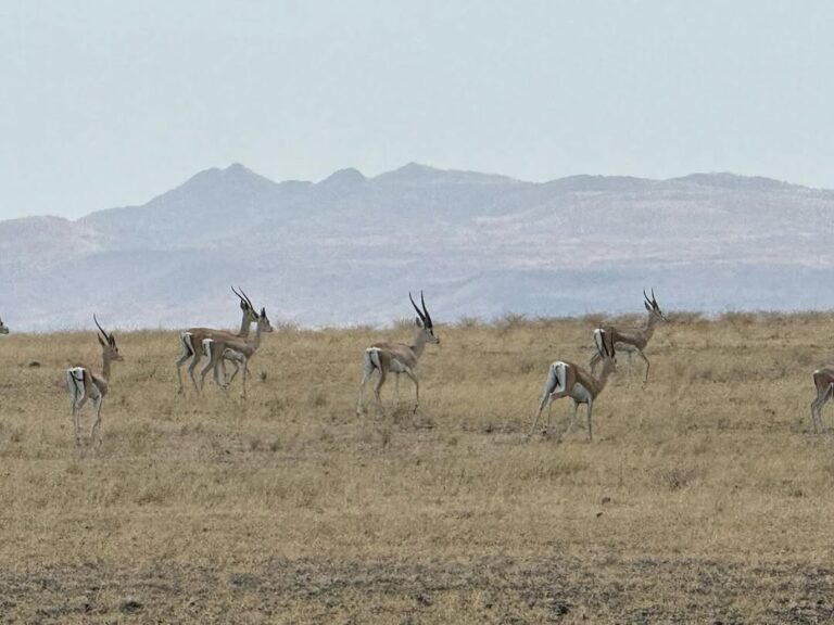
Wildlife still matters. Crocodiles, fish, hippo, waterbirds and desert-adapted terrestrial species belong to the wider ecosystem. Yet the strongest reason to travel here is the whole landscape: a closed Rift Valley basin, volcanic islands, fishing settlements, fossil beds, immense wind and a sense of distance that cannot be manufactured beside a convenient airstrip.
That remoteness is not a badge of hardship. It is the reason route design, vehicle preparation, local knowledge and honest contingency matter. A well-planned private expedition gives the lake time to reveal itself without turning long driving days into a test of endurance.
A great lake held inside the Rift
Lake Turkana occupies a closed basin in the eastern branch of the Great Rift Valley. It has no outlet to the sea. The Omo River, flowing south from Ethiopia, provides the large majority of its inflow; evaporation removes water from the basin. Rainfall, river flow, upstream development and temperature therefore influence water level, salinity, fisheries and shoreline life far beyond the place where change begins.
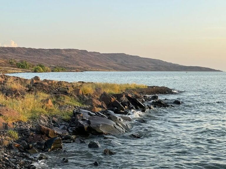
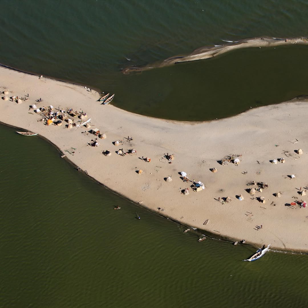
It is the world’s largest permanent desert lake and the most saline of Africa’s large lakes. Those facts are useful, but they do not describe the experience. From the shore, the opposite side may disappear into heat. Lava fields run into water. Escarpments and extinct volcanoes make distance difficult to judge. The lake behaves less like a calm inland attraction than a body of water with its own weather.
Volcanic country and deep time
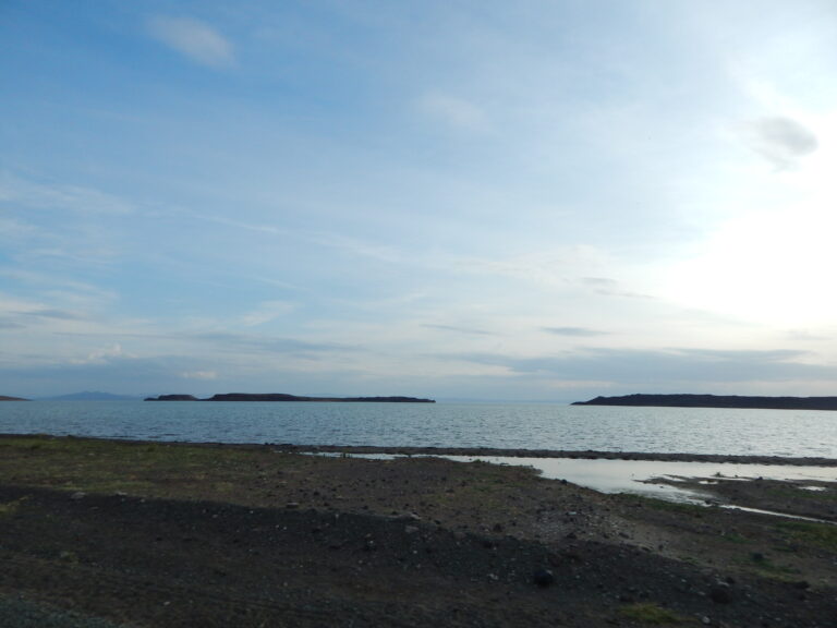
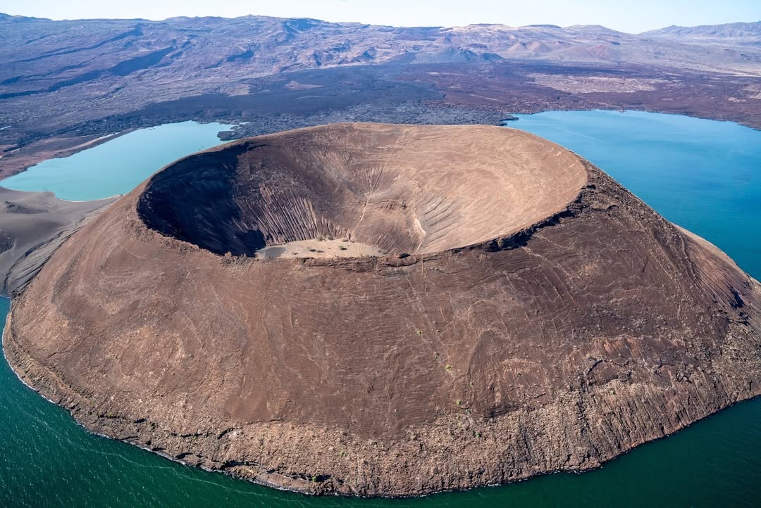
Faulting, eruptions, ash falls, river sediments and changing lake levels built the Turkana basin over millions of years. Central, South and North islands are volcanic. Dark basalt, tuff, old craters and exposed sedimentary layers give the shoreline its severe architecture.
That geology also preserves evidence. Around Koobi Fora, layered river and lake deposits contain animal fossils, stone tools and hominin remains that allow scientists to compare anatomy, climate and behaviour through long sequences of time. The significance is not one dramatic object or a simplified “missing link”. It is the relationship between many finds, their dated layers and the environments in which earlier species lived.
The lake: colour, wind and conditions
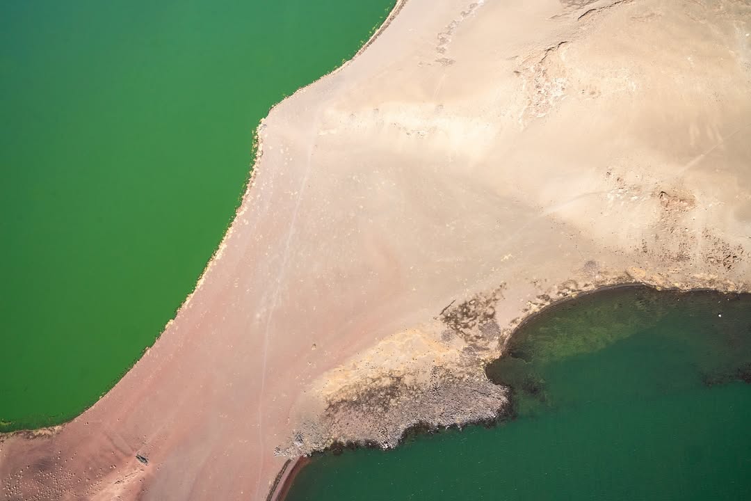
“Jade Sea” is a memorable name, not a promise of one colour. Algae, sediment, cloud, wind and the angle of the sun alter the surface by the hour. Calm morning water may appear pale green; a clear high sun can produce hard turquoise; storm light turns it steel. From a ridge, the lake can look almost unreal. At shore level, its weight and movement are unmistakable.
Wind is part of the geography, not an inconvenience added to it. It can build steep short waves quickly, change boat plans and affect dust, visibility and photography. A safe itinerary treats the lake surface as information. We do not pressure a skipper to depart when local judgement says conditions are wrong, and we do not sell an island crossing as guaranteed before boat, fuel, safety equipment, park arrangements and weather are confirmed.
One lake, several very different journeys
There is no single “Lake Turkana tour”. The eastern shore, western shore and protected northern basin require different routes.
The eastern approach
The classic overland approach from Nairobi runs north through the highlands and Samburu country towards Marsabit, then crosses the Chalbi region before reaching Loiyangalani on the south-eastern shore. It is the most coherent route for travellers who want landscape change, desert driving, community context and the drama of arriving by road.
The western approach
Lodwar and Kalokol provide access to the western shore. This side can work for Central Island plans and routes shaped around Turkana County, but it is not casually interchangeable with Loiyangalani. The lake, long road distances and variable shoreline tracks separate the two sides.
The north-eastern extension
Sibiloi National Park and Koobi Fora lie far beyond the southern lake. They need a separate expedition extension with fuel, water, high-clearance four-wheel drive, park and museum coordination and realistic daily distances. They cannot be honestly added as an afternoon excursion from Loiyangalani.
Loiyangalani: where mountain, desert and water meet
Loiyangalani sits beneath Mount Kulal near the south-eastern shore. Springs and palms soften the immediate setting, but the wind and exposed lake remain close. The town is a practical base for rest, local guiding, cultural interpretation and assessment of road or boat conditions. It is also one of the clearest places to understand the cultural geography of the southern lake.
A good stay is not built around driving in, photographing the palms and leaving. Time allows for the shoreline at different light, conversation with local hosts, the Desert Museum when open, and a better understanding of how fishing, livestock, trade, schooling and modern work meet in a remote town.
Central Island National Park
Central Island is a compact volcanic national park almost in the middle of the lake and part of the UNESCO Lake Turkana National Parks World Heritage property. Craters, sulphurous ground, lava and bird habitat make it a geological journey as much as a boat excursion. Migratory and resident waterbirds use the island, and protected lake habitat is important for Nile crocodile breeding.
Access depends on the correct shore, a suitable boat, an experienced skipper, lifejackets, fuel, KWS procedures and safe water. Landing points and walking routes must follow current park direction. Heat reflected from rock and water can be severe; visitors carry drinking water, sun protection, first aid and sturdy footwear.
Sibiloi National Park
Sibiloi protects a remote sweep of north-eastern shoreline, desert plain, fossil landscape and important archaeological sites. Established in 1973, it forms the largest component of the Lake Turkana National Parks World Heritage property. Wildlife may include Grevy’s zebra, Somali ostrich and other desert-adapted species, while the wider lake supports important bird and crocodile habitat.
Animal sightings here should not be marketed like a conventional game-drive checklist. The park’s force comes from scale, palaeontology, geology and the meeting of desert and water. High-clearance four-wheel drive is essential, and travelling with more than one properly prepared vehicle may be prudent on the most remote sectors.
Koobi Fora and the human story
Koobi Fora lies within the greater Sibiloi landscape on the eastern side of the lake. National Museums of Kenya describes an extensive sequence of river and lake sediments spanning broadly from the Pliocene into the early Pleistocene. Hominin fossils, stone artefacts and animal remains recovered from the area have transformed scientific understanding of human evolution and past environments.
Visitors enter a research landscape, not an open fossil hunt. Museum and field interpretation should be arranged with the relevant authorities and local expertise. Fossils, fragments and archaeological material are never collected or moved. The most rewarding visit is guided slowly enough to connect sediment, climate, anatomy and time.
Communities and cultural geography
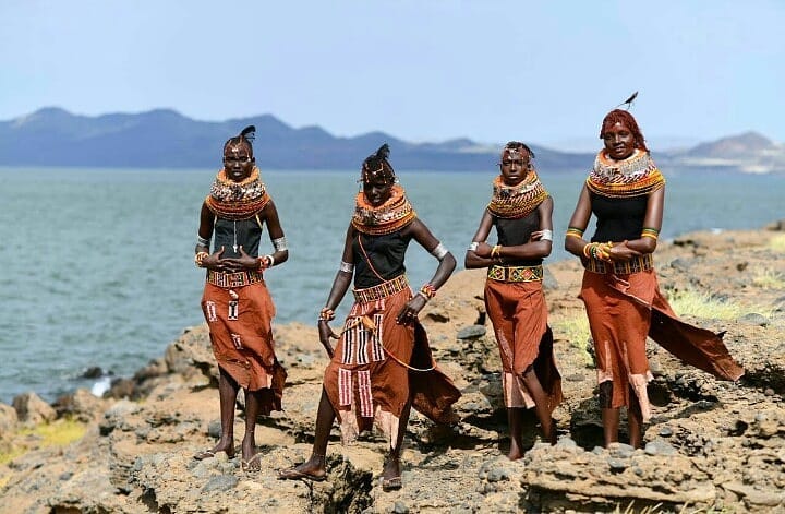
Turkana, Dassanech, El Molo, Rendille, Samburu, Gabbra and other communities live around or move through the greater basin, each with distinct histories, languages and livelihoods. Fishing, herding, trade and wage work respond to a place where lake water can be abundant while safe fresh water remains scarce.
We do not use the language of “tribes untouched by time”, and we do not arrive in a settlement with an unannounced camera. The strongest encounters are agreed with local hosts: a fisher explaining wind and nets, a guide reading springs and grazing routes, or a museum interpreter connecting local history to the wider basin. Permission is required for every recognisable portrait, and commercial image use is a separate conversation.
Fish, crocodiles and birds
Lake Turkana supports important fisheries and lakeshore livelihoods. Species and catches respond to water conditions, river inflow and fishing pressure. Nile crocodiles breed within the protected lake system; hippo occur in suitable habitat. Both are wild animals in immense water, not guaranteed close sightings, and neither justifies unsafe swimming or boat positioning.
The World Heritage parks and the Mount Kulal–Turkana landscape support resident and migratory waterbirds. Pelicans, cormorants, herons, gulls, terns, waders and other species shift with water level, food and season. Serious birding requires time, suitable optics and local knowledge rather than a hurried island crossing.
Photography with Kenny
Turkana rewards photographers who show scale. Black basalt can anchor a wide frame; a boat, person or vehicle can make distance legible; layers of water and escarpment can compress beautifully through a moderate telephoto. Fast shutter speeds help from a moving boat, while careful exposure protects bright water, pale sky and dark lava in the same scene.
Dawn and late afternoon soften the basin, but hard midday light also belongs here. Heat shimmer can become part of the image. Dust requires disciplined lens changes, and boat work needs straps, dry protection and a realistic expectation of movement.
Kenny teaches field craft as well as camera settings: anticipating subject movement, choosing a background before the moment arrives and recognising when a respectful photograph is not available. Fishing, worship, a family home or a difficult working moment never becomes visual property without consent.
How to reach Lake Turkana
Most of our eastern-shore expeditions travel overland in a prepared four-wheel-drive vehicle through Samburu or Isiolo, Marsabit and the Chalbi region. This allows the landscape to change gradually and makes the journey part of the story. Daily plans depend on road reports, fuel, water, vehicle condition and where an overnight can be made responsibly.
Air access can shorten particular routes through Lodwar, Marsabit, Loiyangalani or private/park airstrips when an appropriate current service or charter is confirmed. A flight does not remove the need for local ground transport and contingency. Schedules, airstrip condition and baggage limits must be checked for the actual travel dates.
Where to stay and camp
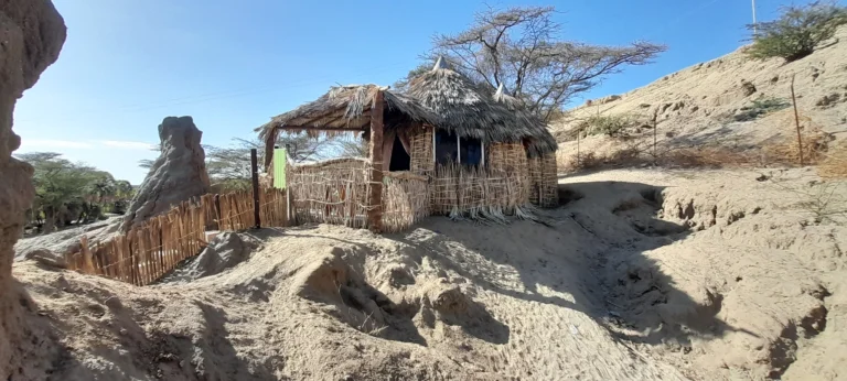
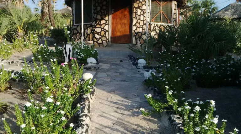
Accommodation varies sharply by shore and route. Loiyangalani has simple lodges and camps used for the south-eastern lake. Lodwar and the western side offer a different range of town and lakeshore options. Sibiloi has limited park and private facilities, and some itineraries depend on properly supported camping.
Comfort should be described honestly. Electricity, water pressure, cooling, communications and supplies may not match a classic safari lodge. What matters is choosing the right standard for each guest, confirming what is operating, carrying adequate water and food, and never assuming that an old listing is still available.
When to go
Heat is a year-round part of Lake Turkana. Wind has daily and seasonal patterns, while rain anywhere along the wider route can alter clay surfaces, river crossings and access. Drier periods may improve some roads but bring more dust and harder light. Rain can briefly transform vegetation yet make a planned desert line impassable.
There is no responsible one-line “best month” for every Turkana itinerary. We select timing around the full circuit, current access and the guest’s priorities, then protect the route with weather and vehicle contingency.
How many days make sense?
Two nights at Loiyangalani offer an introduction after an overland arrival, but leave little flexibility for wind or deeper local exploration. Three nights create a better rhythm for photography, interpretation and a possible boat plan where conditions allow.
A serious Marsabit–Chalbi–Loiyangalani expedition normally needs at least a week from Nairobi, and often longer when Samburu or Ngurunit is included. Sibiloi and Koobi Fora add several more days. We would rather remove a name from the itinerary than reduce every place to an arrival photograph.
Who Lake Turkana suits
- Travellers drawn to expedition geography, archaeology, culture and photography.
- Repeat safari visitors who want to understand Kenya beyond the classic wildlife circuit.
- Guests comfortable with heat, long road days and flexible decisions.
- Families or private groups whose ages, medical needs and comfort expectations have been discussed honestly.
It is less suitable for travellers who need every day to run to a fixed minute, expect continuous large-mammal sightings or require luxury infrastructure throughout the route. A private plan allows us to match road hours, accommodation and contingency to the people travelling.
Combining Lake Turkana with Northern Kenya
Lake Turkana is the flagship lake chapter of a much larger region. Our Northern Kenya guide explains how the reserves, mountains, Marsabit highlands and Chalbi basin fit into a coherent overland route.
Marsabit and Chalbi
This is the natural eastern approach: cool mountain forest and crater country at Marsabit, the exposed Chalbi basin, then the descent to Loiyangalani. The contrast is one of the finest landscape sequences in Kenya.
Samburu and the Ewaso Nyiro
Samburu adds concentrated wildlife, riverine habitat and a comfortable beginning or end to a more demanding northern expedition. Enough days are needed so the reserve does not become merely a transit night.
Ngurunit and the Ndoto Mountains
Where current community arrangements, roads and accommodation are confirmed, Ngurunit can break the journey between Samburu country, Marsabit and the lake. It contributes mountain scenery, walking and dry-country context rather than another conventional game-drive stop.
Sibiloi and Koobi Fora
This is the specialist extension for travellers whose priorities include archaeology, geology and the far north-eastern shore. It needs its own time, permissions and logistical structure.
Responsible travel at Lake Turkana
- Use authorised boats, landings, guides and protected-area procedures.
- Carry all waste out and protect scarce fresh-water sources.
- Do not buy, collect or move fossils, archaeological material or wildlife products.
- Ask permission before every recognisable portrait and agree commercial use separately.
- Pay local guides and hosts fairly; avoid staged or unannounced visits.
- Treat conservation and development pressures as complex shared issues, not spectacle.
Lake Turkana FAQ
Is Lake Turkana a safari destination?
Yes, but not in the conventional sense. Wildlife, birds and protected areas are part of the journey, while landscape, archaeology, culture, photography and expedition travel carry equal weight.
Can we drive around the whole lake?
Not as a routine tourist loop. East and west require different plans, and shoreline tracks are not continuous or reliably interchangeable.
Can Central Island be visited in a day?
It may be possible from the appropriate shore with a suitable boat, KWS arrangements and safe weather. It is never automatic and should not be promised before local confirmation.
Will we see crocodiles?
Crocodiles live and breed in the lake system, but close sightings are not guaranteed and should never be pursued through unsafe boating or landing.
Is it safe to swim?
We do not recommend casual swimming because of crocodiles, waves, remoteness and conditions that vary by place and day.
How remote is Koobi Fora?
Very. It requires a prepared expedition vehicle, fuel and water planning, park and museum coordination and several additional days beyond the southern lake.
Do we need a private expedition?
Private travel is the most practical way to control daily distance, photography stops, accommodation standard and contingency. It also allows local arrangements to be confirmed for the actual group rather than fitted around a generic circuit.
Plan a private Lake Turkana expedition
Tell us how many days you have, how you handle long road journeys, the comfort level you need and whether your priorities are landscape, archaeology, culture, wildlife or photography. We will choose the right shore, build a realistic northern circuit and confirm boats, parks, accommodation and local arrangements for the actual travel dates.
Plan Lake Turkana with Wilderness Alternative Expedition
Email info@wildernessalternativeexpedition.com or WhatsApp +254 743 789 655.
Roads, park access, museums, boats, wildlife, accommodation and air operations depend on current permission, weather, water and local conditions.