
Wilderness Alternative Expedition guide to Loiyangalani
Loiyangalani sits where a hard road, fresh springs and Lake Turkana finally meet. Palms gather around water beneath Mount Kulal; wind runs along the volcanic shore; fishing boats pull against waves that looked harmless from the road. The settlement is not merely a place to sleep after Chalbi. It is where the eastern-shore expedition begins to make human and geographic sense.
A settlement made possible by water
The name is often translated as ‘place of many trees’, reflecting the palms and vegetation sustained by local springs. That fresh water has long made the area important in an otherwise arid landscape. Lake water, groundwater, livestock and household needs create different relationships with water that a visitor should not confuse.
Mount Kulal rises to the east, influencing cloud and springs; black lava and pale sediment reach towards the lake. The apparent simplicity of blue water and open shore contains a complicated volcanic and hydrological system.
Wind is part of the itinerary
Loiyangalani is famously windy. Mornings may be calmer, while later hours can build waves and lift dust. Wind cools the body but accelerates dehydration, changes boat plans and turns loose equipment into a hazard.
We schedule shoreline photography and any authorised boat activity around local assessment, not a fixed departure printed in Nairobi. If the skipper or guide says the lake is unsafe, the programme changes.
A cultural crossroads
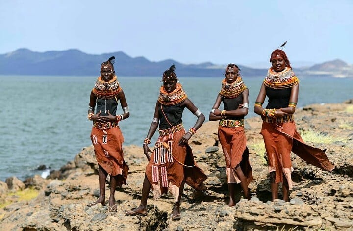
El Molo, Samburu, Rendille, Turkana and other communities have connections to the southern and eastern lake region. Their histories and livelihoods are distinct. The Desert Museum presents regional material and can offer useful context when open, but operating arrangements should be checked rather than assumed.
Community visits are organised with a host and clear benefit. We avoid language that freezes people in the past. Fishing, herding, education, business, religion and migration all belong to contemporary Loiyangalani.
What to do
Walks may explore authorised shoreline, palms, springs, volcanic ground or nearby viewpoints with a local guide. Heat, wind and permission decide length. Birding follows the water and seasonal movement. Market and museum time add context that a landscape-only visit misses.
Longer outings towards Mount Kulal or South Island are separate operations requiring specialised guides, permits, vehicles or boats. They are not casually bundled into a free afternoon.
Photography with Kenny
Morning can bring softer colour and cleaner air; afternoon wind adds texture to water and clothing. Kenny helps guests use people and boats for scale without staging working life, stabilise long lenses in gusts and keep salt and dust away from equipment.
Portraits require specific consent. A wide street or shoreline image does not remove that responsibility when a person is recognisable.
Accommodation and supplies
Loiyangalani offers a small range of simple lodges, camps and community-linked options. Power, water, cooling and communication vary. We confirm the actual property, room and meal plan rather than relying on an old web listing.
Fuel and specialist supplies cannot be treated as guaranteed. The expedition arrives with reserves while buying locally where reliable and appropriate.
How long to stay
Two nights give one full day after the long arrival. Three protect a boat or photographic plan from wind and allow time for museum, community and landscape. Travelling onward to Sibiloi is a separate multi-day commitment.
Responsible travel
- Protect fresh-water sources and carry expedition waste out.
- Use locally authorised guides and boats with safety equipment.
- Ask before portraits, homes, boats, nets or ceremonies are photographed.
- Do not distribute gifts casually or turn children into a photo stop.
- Respect fishing work and shoreline access.
Loiyangalani FAQ
Can we visit an island from town?
Only if a suitable authorised boat, permits and safe lake conditions are confirmed. South Island is the geographically relevant protected island, while Central Island is usually approached from the western side.
Is Loiyangalani connected by tarmac?
Approaches include long rough sectors whose condition changes. It is expedition travel, even as northern roads improve.
Can we climb Mount Kulal?
Only as a separately planned trek with current local permission, guides, water and realistic time.
Plan a private Loiyangalani stay
Tell us whether you are arriving through Chalbi, continuing north or flying. We will confirm accommodation, guide, road and lake conditions and give the settlement enough time to be more than a fuel stop.
Plan Loiyangalani with Wilderness Alternative Expedition
Roads, museums, boats, walks, weather and community access depend on current local conditions and permission.