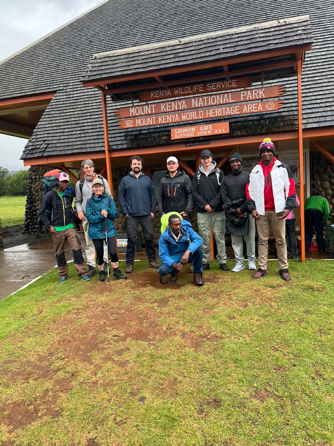
The northern approach to Mount Kenya
Sirimon gives the mountain time to grow around you.
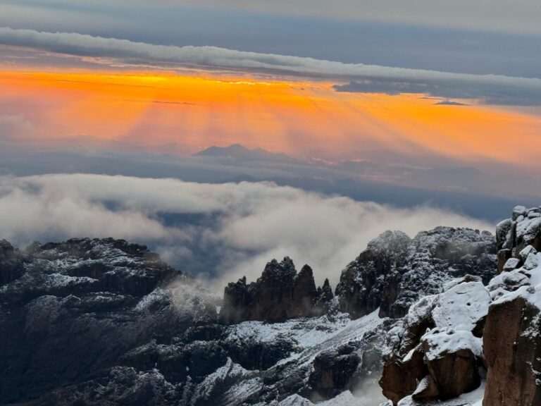
Sirimon begins on the northern side of Mount Kenya, where the country feels open and the great central valleys are still hidden. From the gate, the route climbs through forest to Old Moses, then leaves the trees for heath and wide moorland. The peaks appear gradually. Sendeyo and Terere stand apart from the main massif; ridges fall away to river crossings; and Mackinder Valley finally draws the trail south towards Shipton’s Camp beneath Batian, Nelion and Point Lenana.
That progression is what makes Sirimon such a strong ascent. The walking is purposeful without feeling rushed, and the landscape becomes more alpine with each stage. Old Moses gives the body an early night at height. The next journey into Mackinder Valley opens a long, steady approach rather than a single abrupt climb. By the time the team reaches Shipton’s, the northern faces of the central peaks no longer feel like a distant skyline—they rise directly above camp.
Sirimon is also one of Mount Kenya’s most useful connecting routes. It can be combined with Chogoria to create the classic north-to-east traverse, used as an approach to Point Lenana, or form part of the acclimatisation and access plan for technical climbing on Batian’s northern side. Variations towards Liki North can add a quieter and more demanding line when that choice supports the expedition.
Wilderness Alternative knows Sirimon from repeated field operation, not from a route label. Our guides understand how the northern approach feels at different paces, how guests respond as the sleeping elevation rises and how to use the route as part of a complete Mount Kenya journey. The best Sirimon plan is not simply the one that reaches Shipton’s fastest. It is the one that arrives with energy, appetite and enough acclimatisation for the objective ahead.
Sirimon at a glance
Useful route facts
Figures describe the normal route, but camp use, access and timing are confirmed for the actual departure.
- Approach
- Northern / north-western Mount Kenya from the Nanyuki side
- Entry
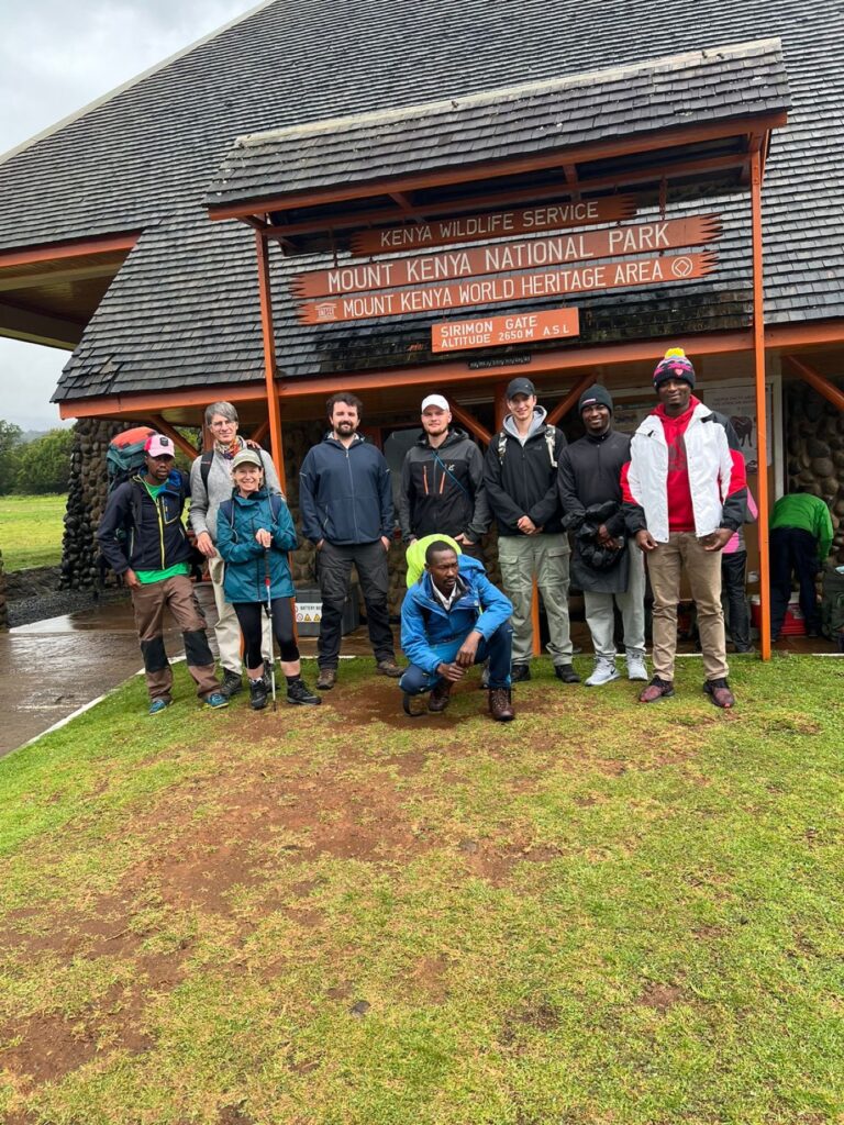
- Sirimon Gate, signed at approximately 2,650 m
- Roadhead
- Old Moses / Judmaier Camp, approximately 3,350 m
- High camp
- Shipton’s Camp, approximately 4,250 m
- Main line
- Old Moses → moorland → Mackinder Valley → Shipton’s
- Variation
- Liki North, a longer and more demanding alternative into Mackinder Valley
- Best known for
- Progressive ascent, open northern views and strong acclimatisation potential
- Common pairing
- Ascend Sirimon and descend through Chogoria
- Summit access
- Point Lenana from the north; Batian’s North Face area via the high northern side
- Typical use
- Excellent ascent route; also a practical northern descent
Why choose Sirimon?
A route with a natural rhythm.
Sirimon’s strength is not that it is “easy”. No route to almost 5,000 metres should be reduced to that word. Its strength is that the approach has a readable shape. The first camp is high enough to begin acclimatisation, but the route still leaves room for a measured walk into the moorland. The second major stage follows rolling terrain before committing to the upper valley. Guests can settle into a pace, and guides have time to observe how the group is adapting.
The northern side is generally associated with drier conditions than the wetter eastern and southern slopes, although Mount Kenya’s weather can change at any time. The open landscape gives long views and makes the geography easy to feel: ridges, rivers and valleys lead the eye towards the central peaks.
Sirimon is established without losing its mountain character. Old Moses and Shipton’s provide recognised camp locations; the trail is familiar to experienced crews; and the route connects naturally with both Point Lenana and the Chogoria traverse. For technical climbers, it also provides the normal northern approach towards Batian’s North Face area.
The landscape
From northern forest to the walls of the central peaks.
Forest and gate
The lower route enters a living montane ecosystem. Forest trees, bamboo zones and wildlife habitat surround the approach before the roadhead. The trail feels sheltered here, with the high mountain still out of sight.
Heath and moorland
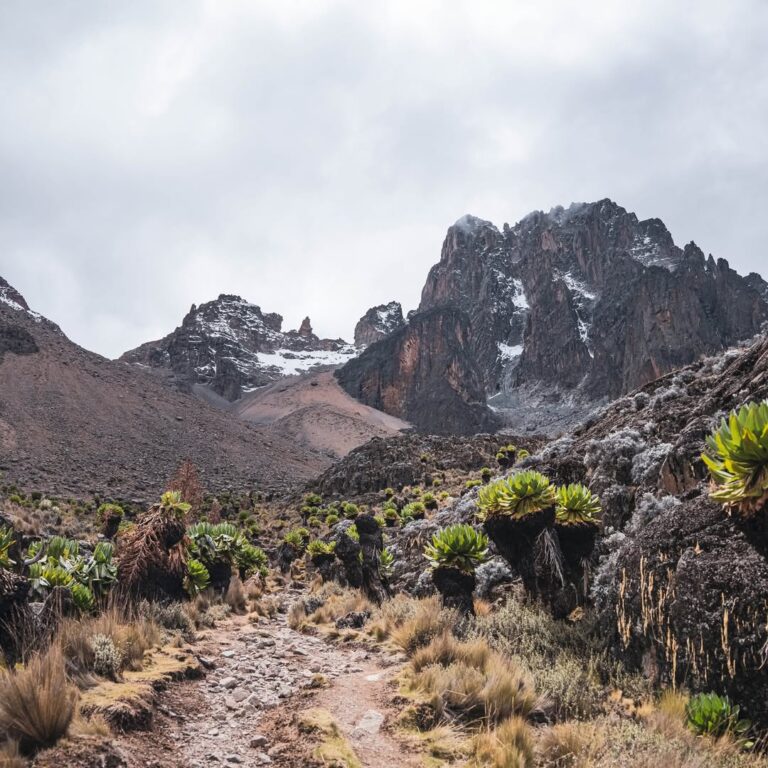
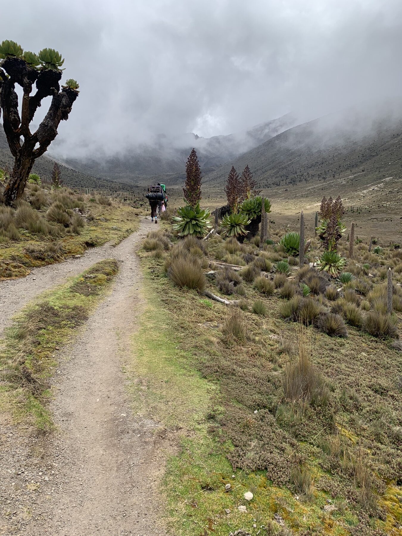
Above Old Moses, trees give way to giant heath, tussock grass and open rolling ridges. Sun can be intense, cloud can arrive quickly and the scale of the northern side begins to emerge.
Mackinder Valley
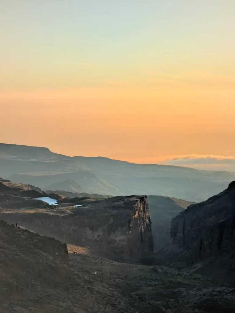
The route crosses the Liki North River and enters a broad glacial valley running towards the peaks. Sendeo and Terere frame part of the approach while the main massif becomes increasingly dominant.
Shipton’s and the high alpine zone
The trail steepens beneath the cliffs near Shipton’s Cave and reaches camp around 4,250 metres. Vegetation is sparse, temperatures fall quickly and Batian’s northern walls rise above the tents and huts.
Old Moses
The first important night of the ascent.
Old Moses—also associated with Judmaier Camp—sits near the Sirimon roadhead at roughly 3,350 metres.
For a well-planned ascent, Old Moses is more than a place to stop. It marks the transition between the lower approach and the open mountain, and it gives the group an early opportunity to sleep at altitude before moving much higher. Guests can organise equipment, meet the rhythm of camp, eat a proper dinner and learn how the evening temperature changes once the sun goes.
Where the wider programme allows, the country above camp can be used for gentle acclimatisation rather than simply waiting for the next morning. The aim is not to tire the group; it is to begin adapting, establish a sustainable walking pace and give the guide an early view of how everyone is responding.
Mackinder Valley
The day the central mountain comes fully into view.
From Old Moses, the normal direct route climbs behind camp, crosses open moorland and contours over a sequence of ridges. After the Liki North River, the trail gains the ridge that opens into Mackinder Valley. This is one of Sirimon’s defining moments: a broad glacial valley leading directly towards the northern side of the central peaks.
The terrain is open rather than technically difficult, but the day is long enough to reward patience. Wind and equatorial sun can be strong, and the final climb towards Shipton’s comes after hours of steady movement. A controlled early pace leaves more energy for the upper valley and supports acclimatisation better than chasing a fast arrival time.
A variation through the former Liki North Hut area is longer and more demanding. It can be valuable for particular expeditions, including access towards Sendeo and Terere or a more exploratory approach, but it is not automatically better than the direct Mackinder Valley line. We choose it when it serves the guest and the objective.

Shipton’s Camp
High camp beneath Batian and Nelion.
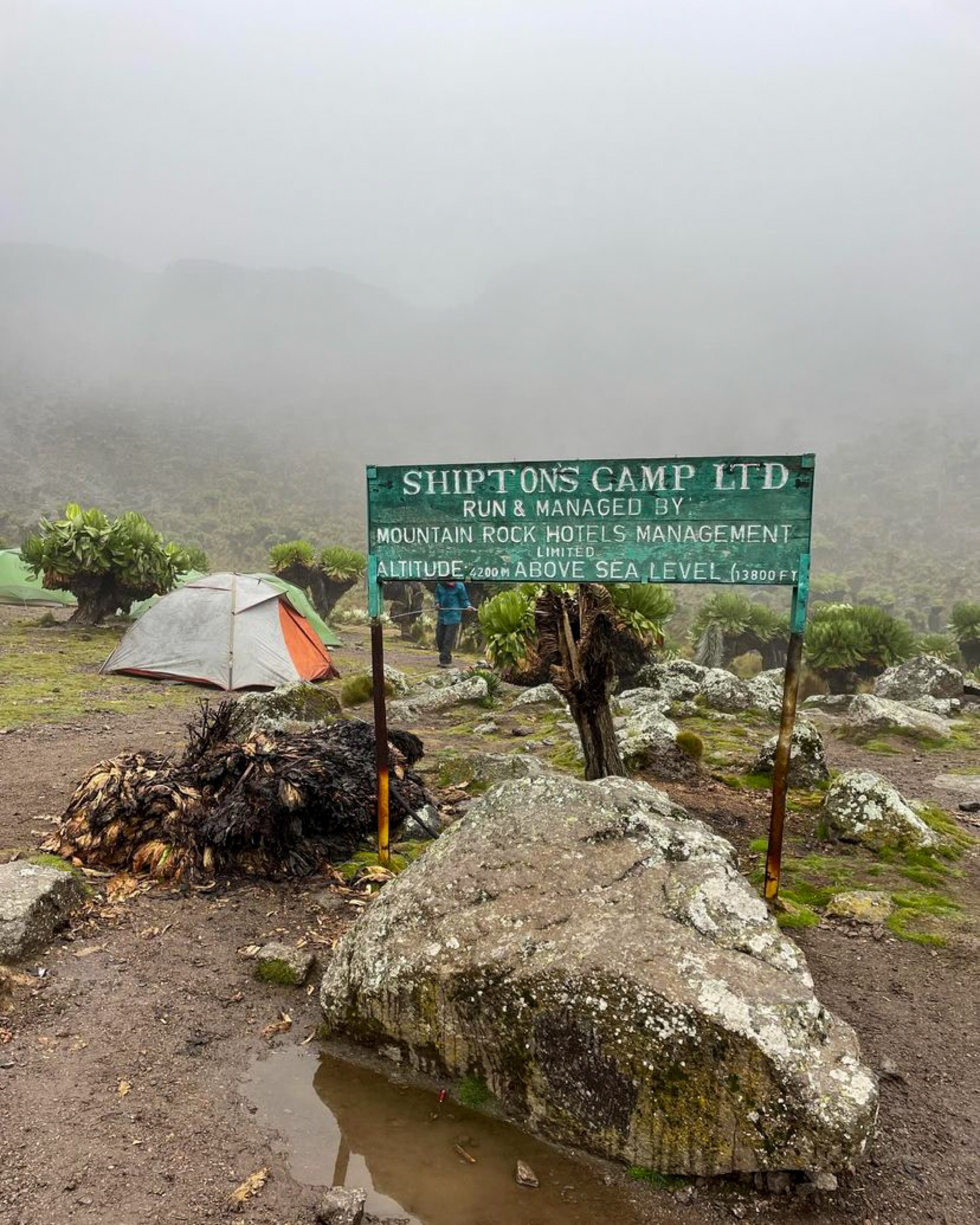
At approximately 4,250 metres, Shipton’s sits in the upper Mackinder Valley directly below the northern walls of the main peaks.
Shipton’s is one of Mount Kenya’s great mountain settings. The scale changes when you arrive: rock towers rise abruptly above camp, temperatures drop quickly after sunset and the route towards Point Lenana disappears into the higher ground. For technical teams, the northern climbing terrain and approaches towards Kami and the North Face are close at hand.
For trekkers, Shipton’s is commonly the high camp before a Point Lenana summit attempt or the transition towards the eastern side of the mountain. Time here is used deliberately. Guests eat, hydrate, prepare warm layers and headtorches, and understand exactly how the next stage will unfold. When the programme includes an acclimatisation walk, the surrounding high ground gives the guide useful options without committing the team to the summit.
Flora and wildlife
A high-altitude ecosystem found only in a few places on Earth.
Sirimon crosses ecological zones quickly enough for their differences to feel dramatic, yet slowly enough to watch the vegetation change.
Giant lobelias
The sculptural leaves and tall flower spikes of giant lobelias are adapted to intense sun by day and freezing temperatures at night. They are part of the living route, not props to be moved or touched for a photograph.
Giant groundsels
These tree-like plants are another signature of the Afro-alpine zone. Dead material around their trunks helps insulate them against the daily freeze–thaw cycle and should never be removed or burned.
High-country wildlife
Rock hyrax and specialised mountain birds may be seen around the valleys and camps. Larger animals occupy the forest and lower slopes but are often hidden by vegetation. We never guarantee a wildlife sighting or feed animals near camp.
Practical Sirimon
Difficulty, water and the way we run the route.
Route difficulty
Sirimon is a non-technical trekking route to Point Lenana, but it is still a high mountain journey. Walking days include sustained ascent, uneven moorland paths, cold conditions and a steep pre-dawn summit approach. Fitness matters, while pacing and enough acclimatisation matter just as much.
Water
Water is collected from appropriate mountain sources by the expedition team, then boiled or treated for drinking. Bottles are refilled and guests carry enough reusable capacity for the walking day. This keeps the system reliable without bringing unnecessary disposable bottles onto the mountain.
Camps
Old Moses and Shipton’s are established locations on the normal Sirimon line, with huts and camping areas. The exact accommodation and facilities used depend on the journey and current arrangements. Our team prepares camp so guests can change, eat and recover efficiently.
Food
Our cooks prepare proper meals for demanding days: soups, breads, vegetables, carbohydrates, proteins, fruit, snacks, desserts and plenty of hot drinks. Menus vary by journey and supplies, and many dietary preferences can be handled with advance notice.
Altitude and acclimatisation
Sirimon works because the ascent can be read and paced.
Altitude is managed through competence: progressive sleeping heights, steady walking, good meals, hydration and communication.
The first night matters
Old Moses places the group at meaningful altitude early in the journey without immediately committing to the high camp. It gives guides time to see how guests sleep, eat and recover.
The valley rewards restraint
The long movement into Mackinder Valley can tempt strong walkers to push ahead. We keep the pace collective and sustainable so the final climb to Shipton’s does not become an unnecessary race.
A fifth day can do real work
Used well, an additional day can add an acclimatisation walk, improve the sleeping profile, create recovery before summit morning or open a more scenic Chogoria variation after the summit.
Communication keeps options open
Guests should report headache, nausea, unusual fatigue, poor appetite or dizziness early. That information allows the guide to respond calmly while simple adjustments are still available.
Sirimon for ascent
Where the route is strongest
The gradual visual and physical progression from Old Moses through Mackinder Valley makes Sirimon particularly effective for ascent. Camp spacing, open terrain and the approach to Shipton’s allow the group to build a rhythm before reaching the highest night. For most first-time traverses, this is the direction we prefer to examine first.
Sirimon for descent
A practical northern exit
Sirimon also works well as a descent from Point Lenana or the high northern side. The trail is established and gives a clear exit towards Nanyuki. A descent itinerary still needs enough time; losing altitude quickly does not mean the team should rush tired legs through the moorland.
Who Sirimon suits
Travellers who want a complete ascent, not only the shortest access.
Sirimon is versatile, but its character is especially attractive to certain guests and objectives.
- First-time Mount Kenya trekkers who value a progressive route and established camp locations.
- Guests making their first journey close to 5,000 metres and willing to take the acclimatisation process seriously.
- Photographers and landscape-minded travellers who enjoy open valleys and changing views of the central peaks.
- Point Lenana trekkers who want to finish through Chogoria rather than retrace one trail.
- Technical climbers approaching the northern side of Batian as part of a properly acclimatised expedition.
- Groups that value strong camp systems, good food and the shared rhythm of an experienced mountain team.
Sirimon + Chogoria
The classic Mount Kenya traverse.
Ascending Sirimon and descending Chogoria connects two completely different landscapes. The northern approach builds steadily through moorland and Mackinder Valley. After Point Lenana, the eastern side opens into Simba Col, Hall Tarns, the Temple, Gorges Valley and the lake country. The journey feels like a crossing rather than an ascent and retreat.
A four-day traverse can suit a fit guest with appropriate recent altitude experience, but it is compressed. A five-day plan creates more scope to use the mountain intelligently: a better-timed sleeping height, an acclimatisation walk, a more measured summit preparation or time around Lake Ellis and the Chogoria valleys. The fifth day should add quality and physiological value, not simply divide the same distance.
Our specific four- and five-day journey pages will set out each day in detail, including sleeping altitudes, distances, terrain, meals and accommodation. Until those are published, we will discuss the exact Wilderness Alternative programme directly rather than presenting a generic operator itinerary as our own.

Sirimon → Chogoria
A focused traverse for fit guests with the right recent mountain and altitude background.
Ask about the 4-day programme →Sirimon → Chogoria
The stronger all-round choice for acclimatisation, recovery and time in the landscape.
Ask about the 5-day programme →Sirimon Route questions
What guests most often ask.
Is Sirimon the easiest route on Mount Kenya?
It is often described as the most gradual of the main approaches, which can make it an excellent ascent route. “Gradual” does not remove the altitude, long walking days or steep Point Lenana summit approach. Its advantage is the shape of the ascent, not a promise that the mountain will feel easy.
Where does the Sirimon Route begin?
The route enters through Sirimon Gate on the northern side of Mount Kenya, approached from the Nanyuki direction. The normal roadhead and first major camp location is Old Moses / Judmaier Camp at approximately 3,350 metres.
How high is Shipton’s Camp?
Shipton’s sits at approximately 4,250 metres in the upper Mackinder Valley beneath the northern side of the central peaks.
Is Sirimon good for acclimatisation?
Yes. The progression from Old Moses into Mackinder Valley gives the route a useful shape for acclimatisation, especially when the itinerary includes enough time and a well-used fifth day. Individual response still varies, so guides monitor guests throughout.
Can beginners use the Sirimon Route?
Many first-time high-altitude trekkers use Sirimon successfully. Guests should arrive with good walking fitness, appropriate clothing and footwear, and enough time for the ascent. We recommend the number of days after discussing recent trekking and altitude experience.
Do we sleep in huts or tents?
Old Moses and Shipton’s have established hut and camping areas. The exact Wilderness Alternative arrangement depends on the programme, group and current availability, and is confirmed before departure.
Can Sirimon be used to reach Batian?
Yes. Sirimon provides access to the northern side of the central peaks and is the normal approach for technical objectives on Batian’s North Face. That expedition requires technical climbing experience and a separate acclimatisation and equipment plan.
Is Sirimon better up or down?
It works in both directions, but its progressive landscape and altitude profile make it particularly attractive as an ascent. Pairing it with a Chogoria descent gives one of Mount Kenya’s most complete trekking journeys.
How long does Old Moses to Shipton’s take?
The normal direct line is commonly described as a full walking day of roughly six to seven hours for a moderately fit party, while the Liki North variation is longer. Actual time depends on the group, conditions, load and guide’s pacing; our itinerary uses ranges rather than a promise to arrive on a fixed minute.
Plan a Sirimon journey
Let Sirimon be the beginning of a complete Mount Kenya crossing.
Tell us your dates, recent trekking, altitude experience and whether you prefer a focused four-day traverse or the stronger five-day progression. We will recommend the programme that fits the guest and the mountain.
Continue to the Chogoria guide → · Point Lenana guide → · Planning guide →
Route elevations and geography are checked against current specialist Mount Kenya guidance; camp operations, access and facilities are reconfirmed for the departure.