The eastern approach to Mount Kenya
Chogoria is a journey through the architecture of the mountain.
Chogoria enters Mount Kenya from the east, beginning beyond the cultivated country around Chogoria town and climbing through forest towards the open mountain. It is not one fixed trail but a family of lines through lakes, gorges, cliffs and high tarns. That variety gives the route its depth. A journey can turn towards Lake Ellis, follow the edge of Gorges Valley, look down on Lake Michaelson and the Temple, or move through Hall Tarns and Mintos towards the high crossing below Point Lenana.
The scenery unfolds at several scales. Lake Ellis sits in open moorland with long skies and space around it. Gorges Valley feels larger and more enclosed, its volcanic walls revealing how deeply erosion has cut the old massif. Lake Michaelson lies beneath the Temple in one of the mountain’s most complete glacial settings. Higher still, Hall Tarns, Mintos, Simba Tarn and Simba Col belong to the cold upper route where vegetation gives way to rock.
Chogoria works beautifully in either direction. As an ascent it rewards travellers who want a longer, more exploratory approach with time among the eastern landscapes. As a descent after Sirimon and Point Lenana it provides a magnificent change of scene, finishing the journey somewhere completely different from where it began. The right choice depends on acclimatisation, current road access, camp plan and the features the guest most wants to experience.
We treat Chogoria as a landscape system, not a single checklist. Conditions on the forest road, water availability, park instructions and the group’s pace influence which variations make sense. The result should feel coherent: every lake, viewpoint and camp must contribute to the journey rather than become an unnecessary detour.
Chogoria at a glance
A route with several legitimate expressions.
Access, camp positions and the upper line are reconfirmed for each departure rather than copied from an old itinerary.
- Approach
- Eastern Mount Kenya through Chogoria town and the forest
- Official access
- Chogoria Gate; the condition of the road towards the mountain is checked before travel
- Lower features
- Meru Mount Kenya Bandas area, forest, roadhead and Nithi country
- Lake line
- Lake Ellis with possible links towards the Nithi landscape
- Valley line
- Gorges Valley, Lake Michaelson and the Temple
- Upper features
- Hall Tarns, Mintos, Simba Tarn and Simba Col
- Character
- Long, intricate, spacious and exceptionally varied
- Best use
- A scenic ascent or the defining descent of a Sirimon–Chogoria traverse
- Accommodation
- Camp-based for much of the mountain; exact arrangements are journey-specific
- Summit link
- Point Lenana via the eastern high route, or connection towards Shipton’s
The route in four movements
From forest road to the cold edge of the central peaks.
Chogoria and the forest
The approach leaves farms and town behind, entering montane forest and bamboo. Vehicle access can change with rain and road condition, so the walking start is a live operational decision.
Open moorland
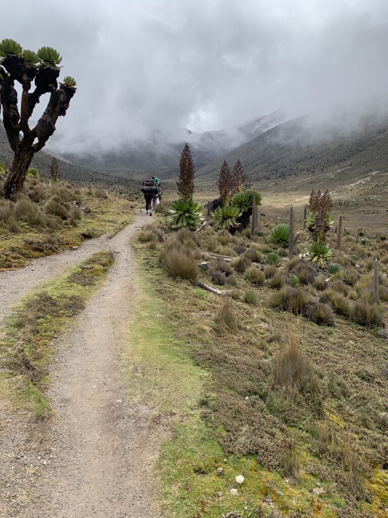
Above the forest, giant heath, tussock grass, lobelias and broad skies introduce the eastern plateau. Lake Ellis belongs to this more open expression of Chogoria.
Gorges and lakes
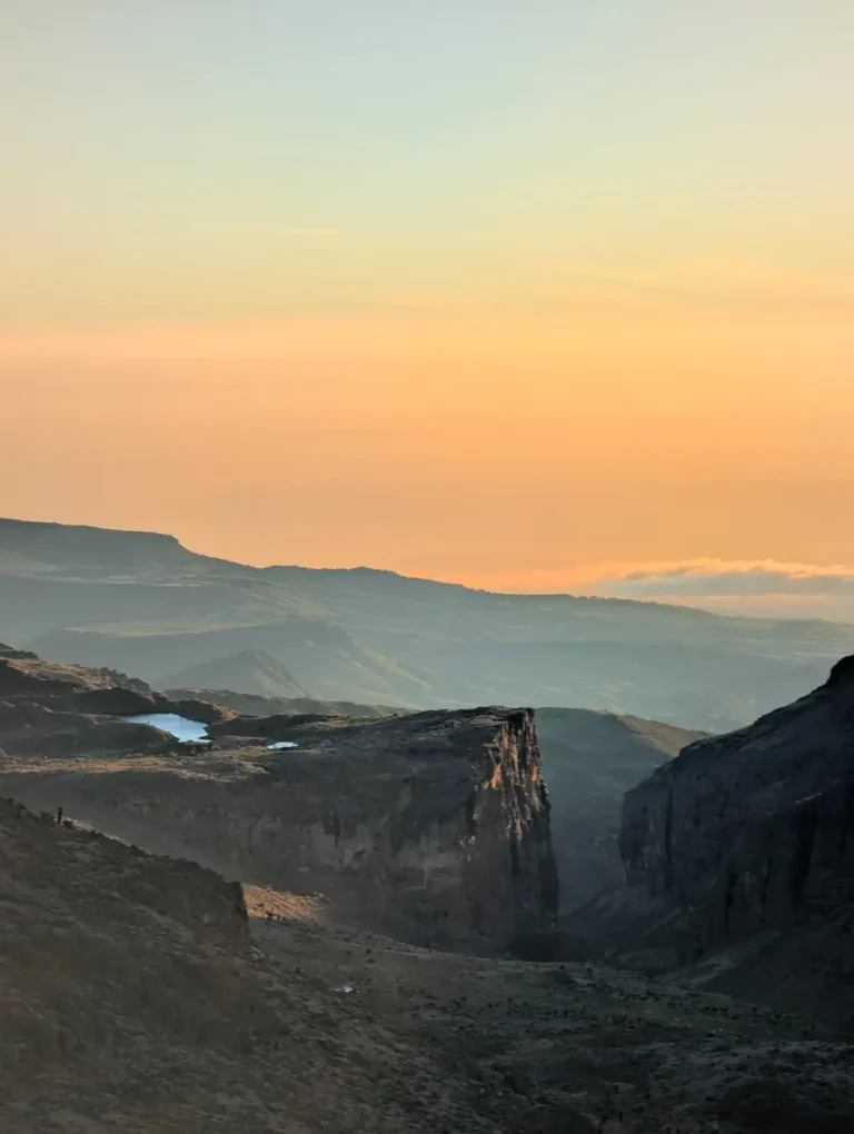
The route approaches the volcanic cliffs, with views into Gorges Valley and towards Lake Michaelson beneath the Temple. Distance begins to feel vertical as well as horizontal.
Tarns and high cols
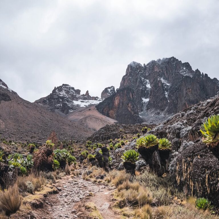
Hall Tarns, Mintos and the Simba country lead into sparse, cold terrain. From here the route can connect to Point Lenana, Austrian Hut or the northern side according to the journey.
Lake Ellis
A place worth building time around.
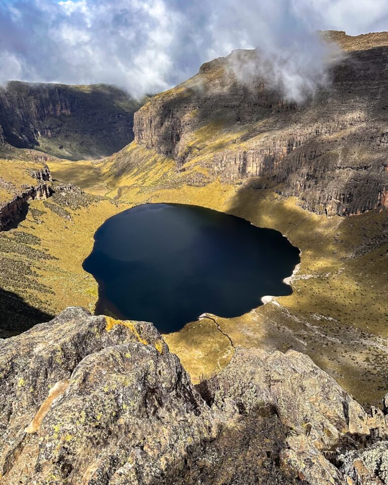
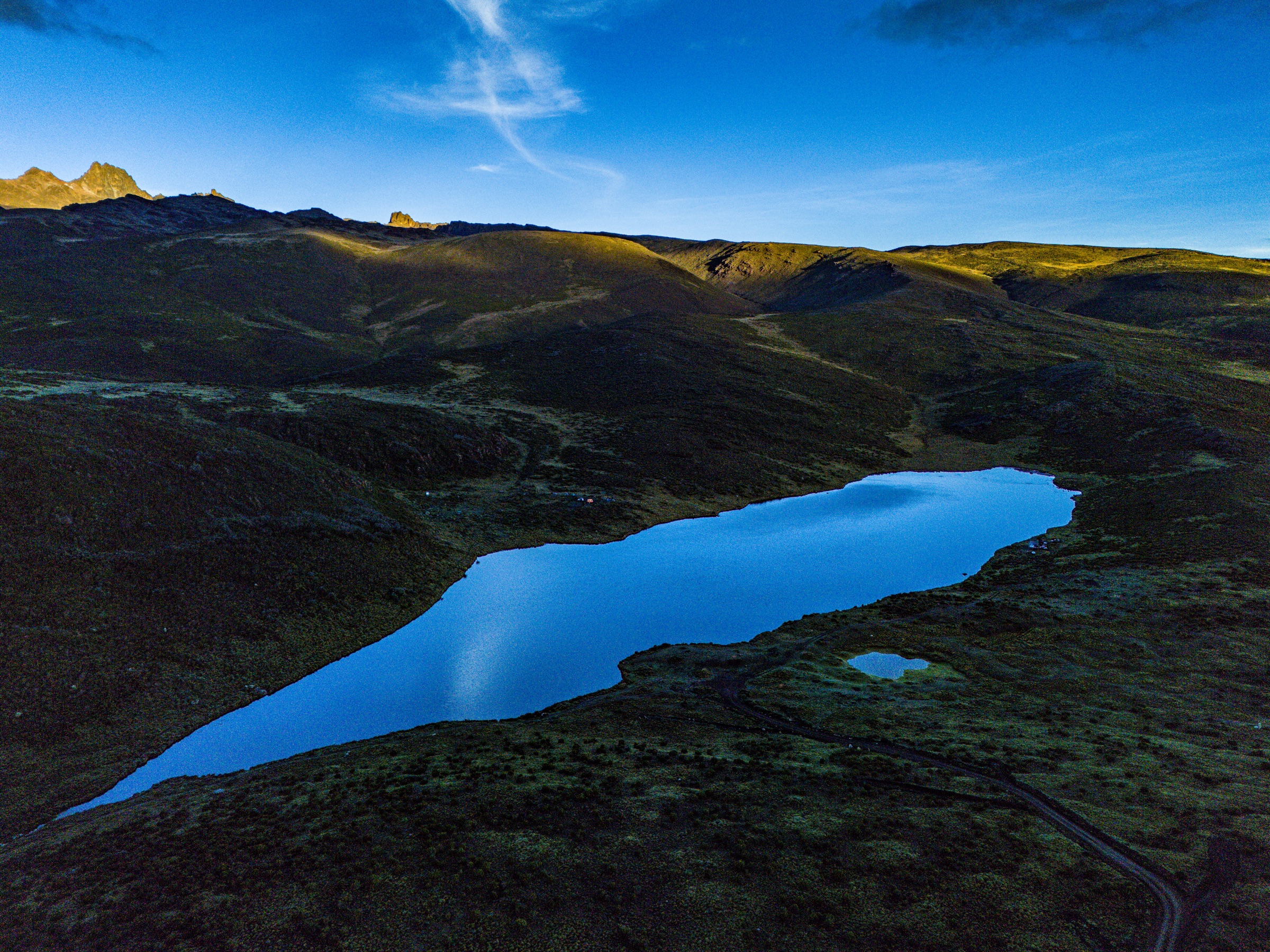
Seen from above, Lake Ellis reveals the scale of the eastern moorland: a blue shape held among rounded volcanic slopes, tracks and wide unbroken ground. On foot it feels equally spacious. The mountain’s central peaks may still seem distant, which is precisely the value of the place—it gives the journey room before the terrain tightens into cliffs and high cols.
An itinerary may deliberately visit or camp near Lake Ellis for landscape, photography and acclimatisation rather than simply ticking off another name. A slower day here can be physiologically useful and emotionally memorable. The exact camp position, access and water plan are confirmed for the individual expedition.
Nearby features associated with the lower eastern side include Nithi Falls, Nithi Gorge and Mugi Hill. Whether they are included depends on the chosen line and time available; Chogoria rewards focus more than an attempt to collect every feature in a single hurried programme.
Gorges Valley
Where the old volcano is opened into view.
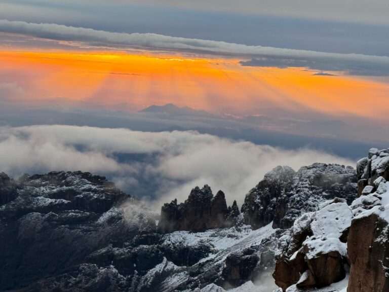
Gorges Valley is one of Chogoria’s defining landscapes: a deep glacial valley bounded by dark volcanic cliffs and shaped by water, ice and erosion. From the high trail, viewpoints reveal a mountain far more complex than a single cone. Ridges, hanging valleys and rock walls overlap, while cloud moves quickly through the upper basin.
The Giant’s Billiard Table and the Nithi landscape are part of the wider eastern geography. Names can make the route sound like a catalogue, but the experience is spatial: long traverses above the valley, changing angles onto the cliffs and the slow approach to the Temple.
Weather deserves respect here. Open ground can be bright and still in one hour, then covered by cloud or hail in the next. The team keeps waterproofs, insulation and navigation close and uses the terrain without relying on a perfect view.
Why this side feels different
Sirimon is organised by a broad valley leading towards the peaks. Chogoria is organised by alternatives: lake country, gorge rim, high tarns and several ways of connecting them. Its strength is not a single spectacular moment but the accumulation of changing landscapes.
Lake Michaelson
A glacial basin beneath the Temple.
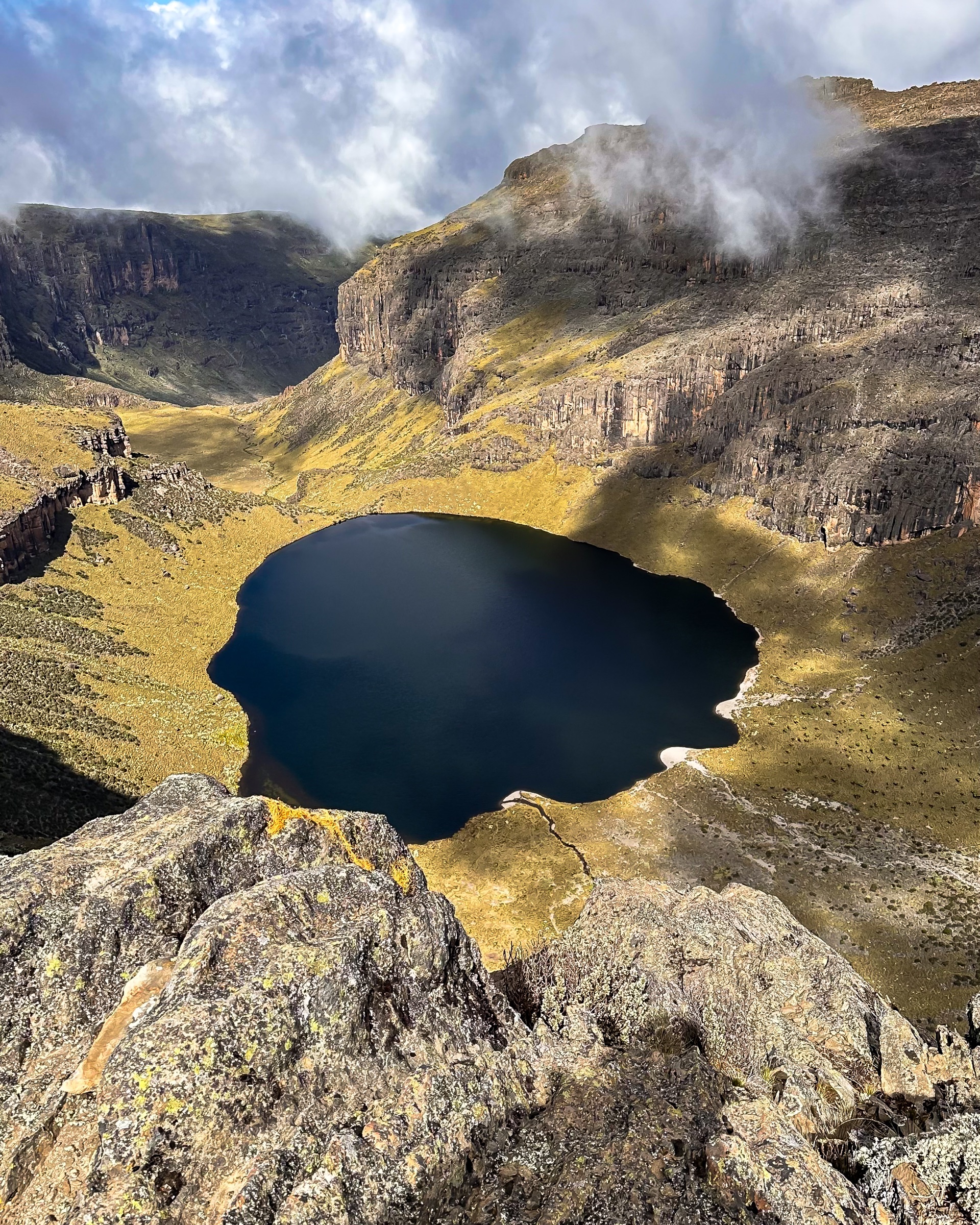
Lake Michaelson lies in a dramatic amphitheatre below the Temple, held between steep volcanic walls at the head of Gorges Valley. Its power comes from the relationship between water and rock: the lake is not an isolated attraction but the dark centre of a much larger glacial basin.
Routes and camp choices around Lake Michaelson require careful planning. The trail, weather and next connection determine whether it becomes a destination in its own right or a viewpoint from the higher Chogoria line. For photographers, the changing cloud and angled light can transform the cliffs within minutes.
Above this country, the route continues towards Hall Tarns and Mintos. The green and ochre moorland thins, the temperature drops and the eastern approach begins to feel like the high mountain rather than the plateau.
Hall Tarns to Simba Col
The landscape narrows towards Point Lenana.
Hall Tarns and Mintos
The upper Chogoria line reaches a beautiful high basin of tarns and rock. Mintos is a recognised camp area used on many eastern-side programmes; current conditions and the group’s sleeping profile guide the plan.
Simba Tarn and Simba Col
The route steepens into loose, cold volcanic terrain. In darkness before a sunrise ascent, pacing and clear guide communication matter more than speed.
Beyond the summit
From the high crossing, a journey may continue to Shipton’s on the north, towards Austrian Hut on the south, or descend the Chogoria side. These are different geographic choices, not interchangeable itineraries.

Practical Chogoria
Beauty depends on strong decisions behind the scenes.
Access
Chogoria is one of Mount Kenya’s three official-gate routes. The forest road and practical roadhead can vary with weather and vehicle conditions, so we confirm how far the team can drive before setting the day.
Water
Lakes and streams do not remove the need for a professional water plan. The team selects appropriate sources, then boils or treats drinking water and protects lakes and drainage lines from soap or waste.
Camping
The eastern approach is strongly camp-based. The mountain team establishes sleeping and shared spaces on durable ground, while facilities remain practical and location-dependent.
Altitude
A longer scenic route is not automatically a gradual route. Sleeping heights, side walks and direction matter. We use the available time to create useful acclimatisation rather than simply adding distance.
Ascent or descent?
Chogoria is rewarding in both directions. Ascent gives its landscapes time to build; descent after Point Lenana offers extraordinary variety but still deserves measured pacing on tired legs.
Who it suits
Landscape-minded trekkers, photographers, first-time Mount Kenya guests with enough days, and experienced walkers who want an intricate rather than direct route.
Route combinations
Use Chogoria to make a crossing, not a return journey.
The detailed Wilderness Alternative programmes will follow in the Trips phase; the geography is already clear.
Sirimon → Chogoria
The classic traverse: progressive northern ascent, Point Lenana and a completely different eastern descent through the lake and gorge country.
Chogoria → Sirimon
A longer scenic ascent with a clear northern exit. It suits guests who want to spend their climbing days in the eastern landscape.
Chogoria + Summit Circuit
For experienced trekkers with strong acclimatisation, the eastern route can connect to a deeper exploration around the central peaks.
Chogoria + Naro Moru
An east-to-west crossing that brings the Temple, high southern side and Teleki Valley into one geographic journey.
Chogoria Route questions
What travellers need to know.
Is Chogoria the best route on Mount Kenya?
There is no single best route. Chogoria offers the greatest concentration of lakes, cliffs and route variations, while Sirimon provides a particularly clear ascent and Naro Moru a direct western line. The best choice depends on the guest, number of days and desired landscape.
Can I camp at Lake Ellis?
Lake Ellis can be included as a deliberate camp or landscape objective when access, park instructions, water and the wider sleeping profile support it. We confirm the exact plan for each departure.
Does every Chogoria itinerary visit Lake Michaelson?
No. Lake Michaelson is part of one important variation in the Gorges Valley system. Other routes use the higher rim, Hall Tarns and Mintos. We choose the line that makes the complete journey strongest.
Is Chogoria suitable for a first Mount Kenya trek?
Yes, provided the itinerary has enough time and is matched to the guest. It is non-technical for Point Lenana but remains a high-altitude mountain journey with long days and variable weather.
Is Chogoria better up or down?
Both are excellent. It makes a deep scenic ascent and an unforgettable descent after Sirimon. Direction should follow acclimatisation, camp plan and the features you most want to experience.
How are food and water handled?
Our cooks prepare varied mountain meals, and the team collects water from appropriate sources before boiling or treating it. Dietary needs should be discussed in advance.
Can Chogoria connect to Point Lenana?
Yes. The upper eastern route reaches the Simba side and connects with the normal trekking summit. The exact summit approach and following descent depend on the chosen programme.
Plan a Chogoria journey
Give the eastern mountain enough time to unfold.
Tell us your dates, recent trekking, altitude experience and whether Lake Ellis, Lake Michaelson, Point Lenana or a full traverse matters most. We will shape the route around the landscape you want to understand.
Current forest-road access, camp arrangements and park requirements are reconfirmed before departure.