
Wilderness Alternative Expedition guide to the Chalbi Desert
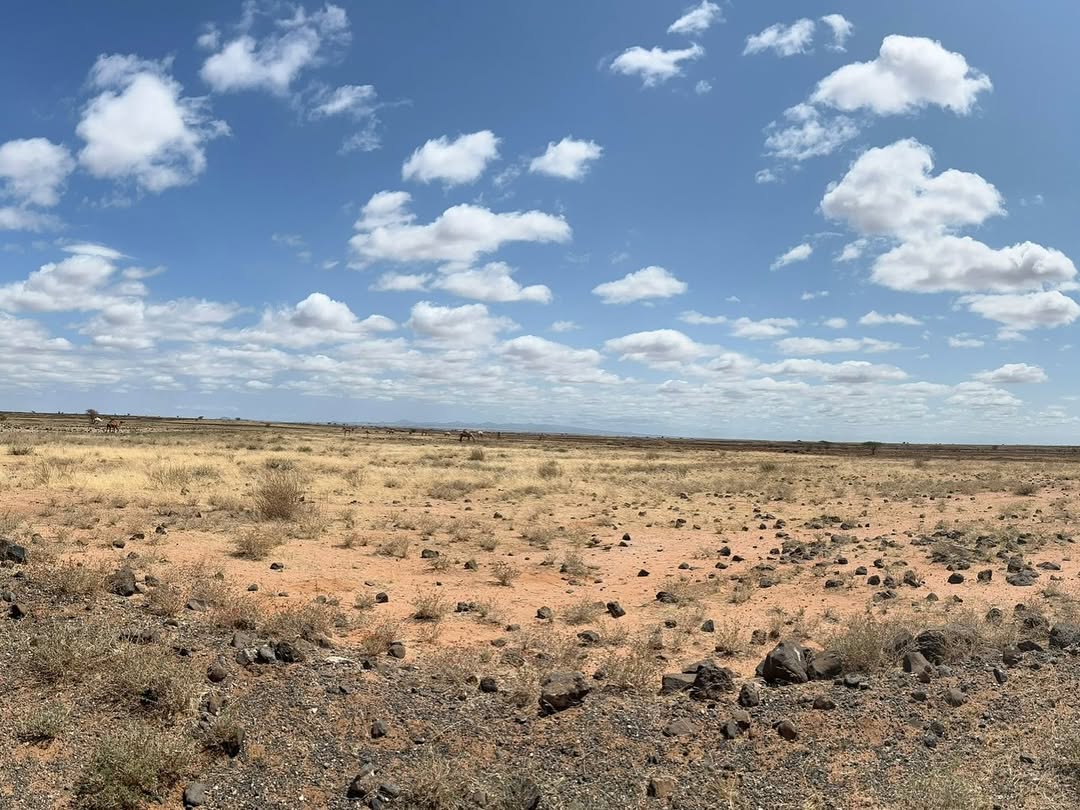
The Chalbi is a horizon built from an old lake. Pale clay and salt run beneath a white sky; black volcanic ridges hang above the plain; heat creates water where none exists. Then wind lifts a curtain of dust and the entire basin changes again. To cross it well is to pay attention to surface, weather and distance—not to race a four-wheel drive into the middle for one dramatic photograph.
A basin left by water
North of Marsabit, the Chalbi occupies a closed depression that once held a much larger lake. Clay, salts and fine sediments accumulated as water evaporated and the basin changed. Today the surface varies from firm, pale pans to cracked mud, sand and seasonally wet ground. Low volcanic hills and the Ethiopian highlands shape the edges of an apparently flat world.
Calling the Chalbi Kenya’s ‘only true desert’ is unnecessary. Desert definitions vary, and the place is more interesting than a superlative. Its character comes from geology, extreme evaporation, sparse rainfall and the way local communities have learned routes between water, pasture and settlements.
Why the surface decides the journey
When dry, some sectors can feel hard and open. After rain, a thin crust may cover deep, adhesive clay. A vehicle can break through and remain stuck far from shade or recovery. Water arriving from distant storms may alter a track even when the sky above the basin is clear.
We use recent reports from drivers and communities, avoid unknown wet pans and keep alternative routes. Tyre condition, recovery equipment, water, fuel and daylight reserve are planned before entry. Desert driving is not a performance; the safest line may be less photogenic and far more intelligent.
Light, mirage and photography
Dawn separates subtle colour in salt and sediment. By late morning, heat shimmer dissolves detail and creates inverted horizons. Evening can turn dust rose or violet while ridges become silhouettes. The basin offers strong minimal images, but scale is difficult to communicate without a vehicle, person, camel or distant escarpment.
Kenny helps photographers protect highlights, keep horizons deliberate and use mirage as subject rather than technical failure. Fine dust enters lens mechanisms and bags; changes are made inside the vehicle where possible. We never place a person or vehicle on an untested surface for composition.
Gabbra country
Gabbra communities have long moved livestock through the greater Chalbi and Marsabit region, adapting camel and small-stock herding to scarce, variable water and pasture. Settlements such as North Horr and Kalacha sit within a living network of wells, markets, schools, ceremonies and modern livelihoods.
A cultural visit is not included by driving into a settlement unannounced. We work with an agreed local host, understand what may be photographed and pay fairly for guiding or activities. The purpose is conversation and context, not proof that people live in a harsh place.
Kalacha, North Horr and route choices
Kalacha lies by springs and vegetation on the western side of the basin; North Horr is another important service and community point north-west of Marsabit. The line between them, Maikona and Loiyangalani changes with the chosen circuit and road conditions. Names on an online map do not show fuel reliability, water, track quality or the hours lost to corrugation.
We decide whether to cross, skirt or enter the basin only after checking the recent situation. A route through Marsabit to Loiyangalani may use different sectors from a dedicated Chalbi–North Horr journey.
Wildlife and birdlife
The barest pan supports little visible wildlife, but the surrounding desert, seasonal water, oases and scrub hold birds, small mammals and dry-country species. Flamingos or other waterbirds may appear when temporary water and food conditions align, but they should never be advertised as a standard Chalbi sighting.
Livestock, tracks and birds often tell more about the basin than a distant large mammal. This is primarily a landscape and expedition destination.
Camping and comfort
Camping inside or beside desert country requires permission, wind judgement, waste management, water and a sheltered cooking plan. Strong wind can flatten a poorly chosen camp and spread litter across kilometres. We favour established or locally agreed sites and leave no trace.
Guesthouses and simple lodgings in regional settlements may be useful, but standards and availability change. We describe them honestly and carry the supplies needed to avoid placing unreasonable demand on local water or food.
When to travel
Dry periods usually offer firmer surfaces, but heat, dust and wind are substantial. Rain brings beautiful skies and life to the margins while increasing the risk of impassable clay and flooded approaches. The relevant question is not simply which month is ‘best’; it is what happened in the basin and on connecting roads during the preceding days.
How long does Chalbi deserve?
One transit day can cross a sector, but two or three nights in the greater desert allow dawn and evening photography, local guiding and a route that does not depend on speed. Chalbi makes greatest sense between Marsabit and Lake Turkana or within a longer North Horr circuit.
Responsible travel in the Chalbi
- Use current local route advice and turn back before a wet surface becomes a recovery emergency.
- Carry water without depleting community sources or leaving plastic behind.
- Obtain permission for camps, walks, wells and community visits.
- Do not drive circles, race vehicles or carve new tracks for photographs.
- Ask before photographing people, livestock enclosures or water collection.
- Leave salt, stone and archaeological material where they belong.
Chalbi Desert FAQ
Can any four-wheel drive cross it?
No. Vehicle type, tyres, driver experience, recent rain, recovery preparation and route choice all matter.
Is there mobile coverage?
Coverage is intermittent and should not be treated as an emergency plan.
Can we camp on the salt pan?
Only with current local permission and a safe assessment of weather, surface and wind. An agreed site on the margin is often better.
Will we see a mirage?
Heat shimmer is common, but its form and strength depend on temperature, light and viewing angle.
Is Chalbi suitable on its own?
It can be, but the deeper journey connects Marsabit’s forest, the desert basin and Lake Turkana’s volcanic shore.
Plan a private Chalbi expedition
Tell us your dates, photographic priorities, camping comfort and wider route. We will check the basin, select a sensible crossing and build enough time for weather, community access and the light that makes the Chalbi legible.
Plan the Chalbi Desert with Wilderness Alternative Expedition
Surface, roads, camps, access and water conditions change with weather and local operations.